My Store
1644 Map Of Africa
1644 Map Of Africa
Couldn't load pickup availability
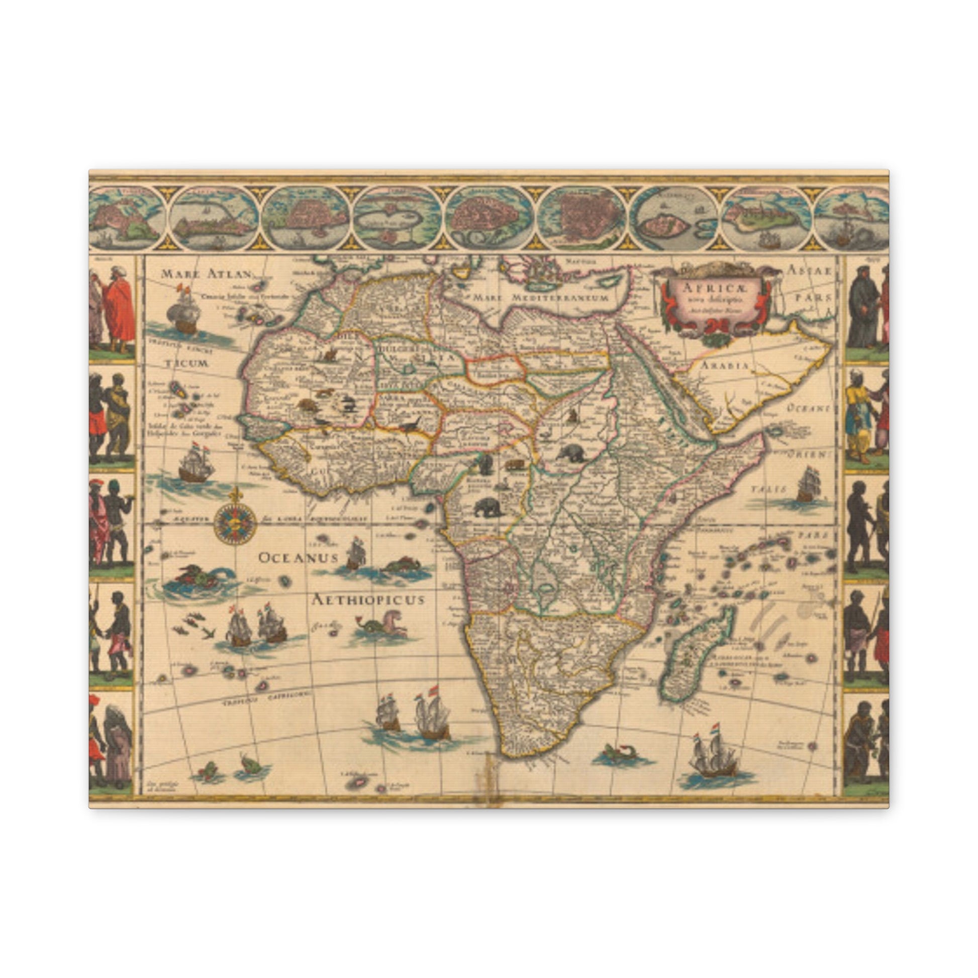
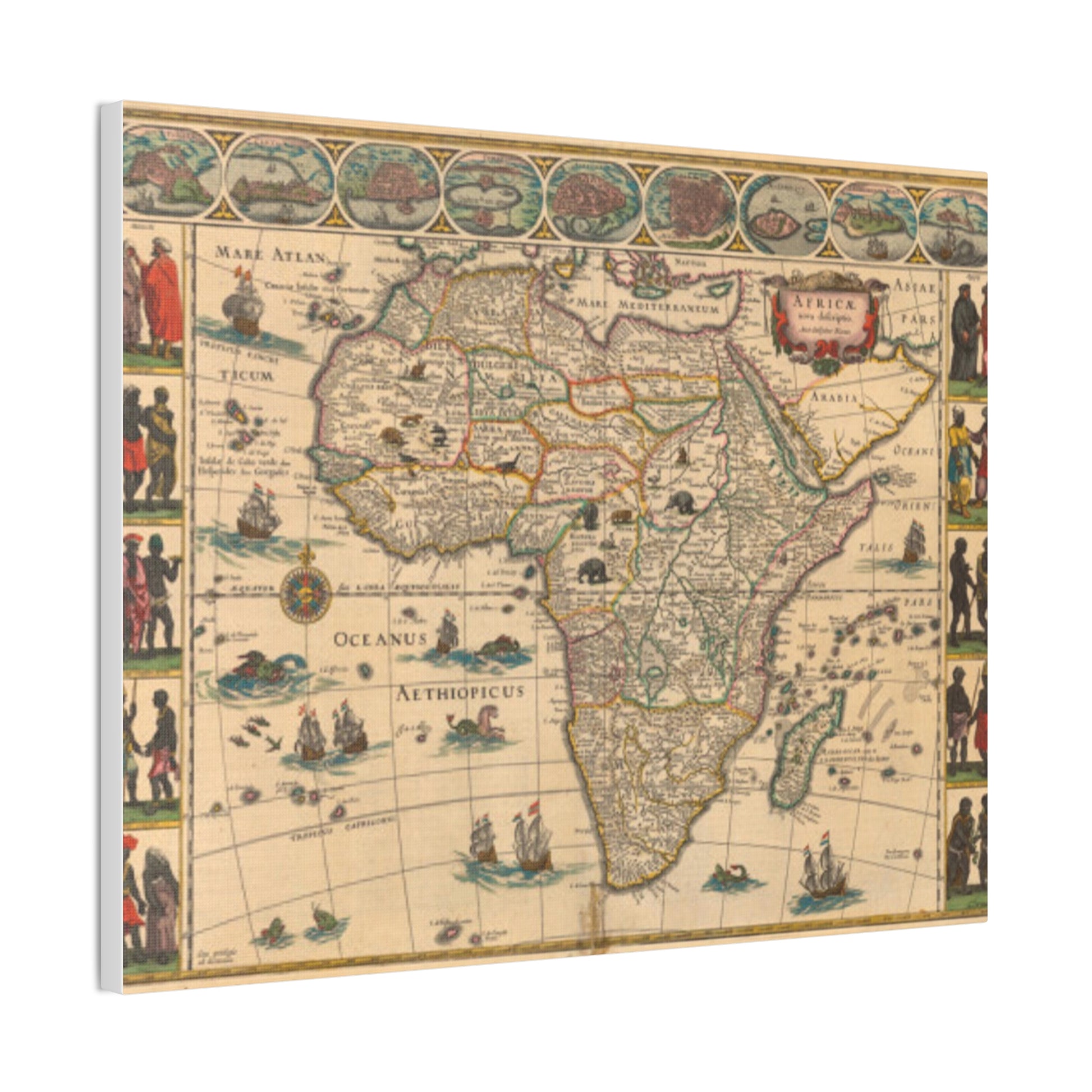
1644 map of Africa, created by Blaeu, Willem Janszoon, between the years 1571 and 1638. Printed in the style known as carte à figures, this map shows views of the major African cities and trading ports at the time: Side panels depict costumed individuals from areas visited along the coasts, including Tangier and Ceuta (Morocco), Tunis (Tunisia), Alexandria and Cairo (Egypt), Mozambique (the seaport of Mozambique), Elmina (Ghana), and Grand Canary (the Canary Islands). Exotic animals like lions, elephants, and ostriches decorate the interior, which has always piqued the public's interest. The Ptolemaic lakes of Zaire and Zaflan are depicted as the source of the Nile—now known as the White Nile. In the oceans, strange flying fish and sea creatures scuffle, and sailing ships all fly Dutch flags. Seaside names are engraved internal to give a reasonable, sharp diagram to the landmass.


